Date of Formation: Haridwar District became the part of Saharanpur Division on 28th December 1988.
Area: 2360 square kilometers
Density of Population: 817 people per square kilometer
Literacy Rate: 74.62 % - Male: 82.26 %, Female: 65.96 %
Male Female Ratio: 1000:879
Boundaries of Haridwar District
North West, West and South: Uttar Pradesh
West: Dehradun District and Pauri Garhwal District, Uttarakhand
Haridwar District Average Rainfall: 751.7 mm
Haridwar District Average Temperature in Summer: 32.06 deg C
Haridwar District Average Temperature in Winter: 13.59 deg C
HARIDWAR DISTRICT MAP

Major Rivers: River Ganges, Ranipur Rao, Pathri Rao, Rawii Rao, Harnaui Rao, Begam Nadi
Tehsils: Haridwar, Roorkee, Laksar
Blocks: Bahadarabad, Bhagwanpur, Khanpur, Laksar, Narsan Kalan, Roorkee
Assembly Constituencies: Jwalapur, Bhagwanpur, Haridwar, Haridwar Rural, Piran Kaliyar, Roorkee, Jhabrera, Manglaur, Khanpur, Laksar
Haridwar District Nearby Attractions
1. Har ki Pauri
2. Sati Kund
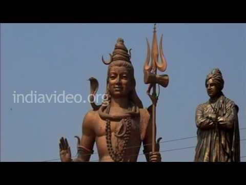
3. Daksheswara Mahadev Temple
4. Maya Devi Temple
5. Sapt Rishi Ashram and Sapt Rishi Sarova
6. Bhimgoda Tank
7. Chandi Devi Temple
8. Piran Kaliyar
9. Ram Mandir
10. Neel Dhara
11. Maya Devi
12. Bharat Mata Mandir
13. Mansa Devi Temple
Haridwar District Facts: This is the most populous district of Uttarakhand.
Major Industries: Hindustan Antibiotics Limited, Bharat Heavy Electricals Limited
Major Educational Institutions: Dev Sanskriti Vishwavidyalaya, Government Ayurvedic College and Hospital, State Ayurvedic College and Hospital, Vishwa Sanskrit Mahavidyalaya,
What is Haridwar District Famous For: Kumbh Mela
Famous People From Haridwar District: Vijay Bose, Satpal Maharaj, Sompal, Hans Ji Maharaj, John Duncan Grant, V.C. Agarwal, Ashok Soota, Proby Cautley
Last Updated : Thursday Jun 14 , 2012