Date of Formation: 25th May 1998
Area: 6615 square kilometers
Density of Population: 183 people per square kilometer
Literacy Rate: 73.22 % - Male: 83.88 %, Female: 62.26 %
Male Female Ratio: 1000:971
Boundaries of Korba District
North: Surajpur District, Koriya District and Surguja District, Chhattisgarh
South: Janjgir Champa District, Chhattisgarh
East: Raigarh District, Chhattisgarh
West: Bilaspur District, Chhattisgarh
Korba District Average Rainfall: 1080.3 mm
Korba District Average Temperature in Summer: 34.62 deg C
Korba District Average Temperature in Winter: 19.51 deg C
KORBA DISTRICT MAP

Major Rivers: Hasdeo, Ahiran, Gagechorai, Tan
Blocks: Kartala, Katghora, Korba, Pali, Pondi, Uproda
Assembly Constituencies: Rampur, Korba, Katghora, Pali, Thanaud
Hills: Gurudwai Hill, Janta Hill, Matin Hill, Dhajag Hill
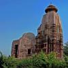
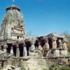
Korba District Nearby Attractions
1. Chaiturgarh
2. Mouhargarh
3. Pali
4. Kanki
5. Sarvamangala
6. Sitamani
7. Tuman
8. Devapahari
9. Kosagaigarh
10. Kendai
11. Madwaarani
12. Kudurmal
Korba District Facts: This is known as the Industrial Hub of Chhattisgarh. There are four thermal power plants located here.
Major Agricultural Products: Wheat, bajra, tamarind, sugarcane, soybean, sesame, safflower
Major Industries: Hasdeo Thermal Power Corporation, Korba Super Thermal Power Station, Bharat Aluminum Company Limited, Indo Burma Petroleum Limited, Indo Gulf Industries, South Eastern Coalfields, Chhattisgarh State Electricity Board
Major Educational Institutions: Government P.G. College, Mini Mata Girls College, Agrasen Girls Degree College, City College, Government Degree College, Government Degree College, Kamala Nehru P.G. College
Mineral Resources: Coal, Bauxite, Granite, Lime Stone, Fire Clay, Brick Clay, Mica, Atomic Minerals, Building Stone, Murram, Sand
Folk Arts: Ravat Nacha, Karma Nacha, Suva Nacha
What is Korba District Famous For: Coal mining
People of Korba District: Pahadi Korwa, Gond, Raj Gond, Kawar, Bhaiyana, Binjwar, Dhanuhar, Satnami, Ganda, Panka
Last Updated : Thursday Jun 14 , 2012


