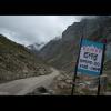
Area: 13,835 square kilometers
Density of population: 2 people per square kilometer
Literacy Rate: 77.24 % - Male: 86.97 %, Female: 66.50 %
Male Female Ratio: 1000:916
Boundaries of Lahaul and Spiti District
North: Jammu and Kashmir
South: Kangra District, Kullu District, Kinnaur District, Himachal Pradesh
East: Tibet
West: Chamba District, Himachal Pradesh
Lahaul and Spiti District Average Rainfall: 2010 mm
Lahaul and Spiti District Average Temperature in Summer: 15.94 deg C
Lahaul and Spiti District Average Temperature in Winter: 2.56 deg C
LAHAUL AND SPITI DISTRICT MAP

Major Rivers: Chandra River, Bhaga River, Chndrabhaga, Spiti River, Tsarab River
Sub Divisions: Keylong, Kaza, Udaipur
Tehsils: Lahaul and Spiti
Sub Tehsils: Udaipur
Assembly Constituencies: Lahaul and Spiti
Passes: Rohtang, Baralacha, Kunzam, Pin Parvati, Ghunsarng, Monirang, Sara Umga, Hamta, Kugti, Kalicho, Tarsalamu
Helipads: Stingri, Barring, Sissu, Tingret, Udaipur, Rawa, Jispa, Tindi
Passes: Hampta Pass, Baba Pass, Pin Parvati Pass
Lahaul and Spiti District Nearby Attractions
1. Pin Valley National Park
2. Spiti
3. Lhalung
4. Kunzum Pass
5. Dhankar
6. Kibber
7. Lossar
8. Rohtang Pass
9. Surajtaal
10. Mrikula Devi Temple
11. Trilokinath Temple
12. Chandrataal
Lahaul and Spiti District Facts: This is the third least populous district in India. Manali to Leh national highway passes through this district.
Major Agricultural Products: Barley, maize, wheat, potato, peas
Major Industrial Products: Carpets, textiles
Fauna: Tibetan antelope, argali, kiangs, musk deer, snow leopards, brown bears, foxes, yaks, dzos
What is Lahaul and Spiti District Famous For: Spiti which is known as the fossils park of the world
Lahaul and Spiti District Pin Codes
Last Updated : Thursday Jun 14 , 2012


