Area: 4391 square kilometers
Density of Population: 32 people per square kilometer
Literacy Rate: 70.40 % - Male: 76.74 %, Female: 63.76 %
Male Female Ratio: 1000:953
Boundaries of Tamenglong District
North: Nagaland
North and East: Senapati District, Manipur
South: Churchandpur District, Manipur
West: Imphal West District, Manipur and Assam
Tamenglong District Average Rainfall: 3135 mm
Tamenglong District Average Temperature in Summer: 25.83 deg C
Tamenglong District Average Temperature in Winter: 16.10 deg C
TAMENGLONG DISTRICT MAP

Major Rivers: Iyei, Irang, Barak, Makru
Sub Divisions: Tamenglong, Tamei, Tousem, Nungba
Assembly Constituencies: Tamei, Tamenglong, Nungba
Tamenglong District Nearby Attractions
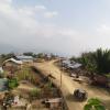
1. Tamenglong – The Paradise Unexplored
2. Tharon Cave
3. Zailad Lake
4. Barak Waterfalls
Tamenglong District Facts: This is the least populous district of Manipur. This is one of the three most backward districts in Manipur that is receiving funds from Backward Regions Grant Fund Program. NH 53 passes through this district.
Major Agricultural Products: Oranges, parkia, papaya, royal chili, pineapple, lime, coconut, mango, litchi
Festivals: Gan-Ngai, Rih-Ngai, Gudui-Ngai, Banruhmei
What is Tamenglong District Famous For: Oranges and Orange Festival
People From Tamenglong District: Tribal people namely Zeliangrong Nagas, Kuki, Chiru, Hmar, Khasi
Last Updated : Sunday Jun 10 , 2012


