Date of formation: 1st December 1963
Area: 1041 square kilometers
Density of population: 213 people per square kilometer
Literacy Rate: 85.58 % - Male: 89.28 %, Female: 81.56 %
Male Female Ratio: 1000: 927
Boundaries of Kohima District
North: Wokha District, Nagaland
South: Manipur
East: Zunheboto District and Phek District, Nagaland
West: Dimapur District, Nagaland
Kohima District Average Rainfall: 2000 mm
Kohima District Average Temperature in Summer: 25 deg C
Kohima District Average Temperature in Winter: 8.1 deg C
KOHIMA DISTRICT MAP

Divisions: Kewhima, Viswema, Kidima, Khuzama, Kezoma, Kezo Basa, Sakhaba, Phesama, Mima, Pfuchama, Jakhama, Kigwema, Jotsoma, Khonoma, Meriema, Mezoma, Gariphema, Tuophema, Botsa, Nerhema, chiephobozou, Chiechama, Chedema, Thizama, Tuophe Phezou, 32 Rengma Naga
Assembly Constituencies: Tenning, Peren, Western Angami, Northern Angami I, Northern Angami II, Tseminyu, Pughoboto, Southern Angami I, Southern Angami II
Kohima District Nearby Attractions
1. Puliebadze Wildlife Sanctuary
2. Tuophema Tourist Village
3. World War II Cementery
4. Khonoma Green Village
5. Kisama Heritage Village
6. Dzulekie
7. Japfu Peak
8. Tseminyu
9. Kohima Zoo
10. Kohima Museum
11. Catholic Church on Aradhurah Hill
12. Bara Basti
13. Naga Bazaar
14. Kohima War Cemetery
Kohima District Facts: This is the second most populous district of Nagaland next only to Dimapur. The nearest aerodrome is at Dimapur.
Major Agricultural Products: Tea, rubber, coffee, paddy, maize, bajra, wheat, jobstear, pulses, lentil, peas, sugarcane, potato, pineapple
Major Indutries: Bee keeping, handmade paper
Banks: State Bank of India, Central Bank, Vijaya Bank, United Bank of India, United Commercial Bank, Bank of Baroda, Nagaland Rural Bank, State Cooperative Bank
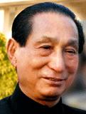
Famous People From Kohima District: Neiliezhu Usou
Last Updated : Thursday Jun 14 , 2012


