Date of formation: Dima Hasao District was formerly called North Cachar District and this came into existence on 29th April 1952. It remained a part of Karbi Anglong District and was made into a separate district on 2nd February 1970.
Area: 4888 square kilometers
Density of population: 44 people per square kilometer
Literacy Rate: 78.99 % - Male: 85.34 %, Female: 72.15 %
Male Female Ratio: 1000:931
Boundaries of Dima Hasao District
North: Karbi Anglong District and Nagaon District, Assam
South: Cachar District, Assam
East: Nagaland and Manipur State
West: Karbi Anglong District, Assam and Meghalaya State
Dima Hasao District Average Rainfall: 2042.1 mm
Dima Hasao District Average Temperature in Summer: 26.48 deg C
Dima Hasao District Average Temperature in Winter: 16.48 deg C
DIMA HASAO DISTRICT MAP

Major Rivers: Jatinga, Jinam, Mahur, Kopili, Diyung, Langting, Dilaima
Sub Divisions: Haflong, Maibong
Developmental Blocks: Harangajao, Jatinga Valley, Diyang Valley, Diyungbra, New Sangbar
Assembly Constituencies: Haflong
Dima Hasao District Nearby Attractions
1. Jatinga
2. Haflong
3. Maibang
4. Umrangso
5. Panimoor
6. Mahur
Dima Hasao District Facts: This region is called Switzerland of the East. It is one of the 11 most backward districts of Assam that is getting grants from the Backward Regions Grant Fund Program. The district was formerly called North Cachar Hills District and was renamed Dima Hasao District on 1st April 2010.
Major Agricultural Products: Paddy, sugarcane, maize, pineapple, orange, potato, ginger, jack fruit, papaya, Assam lemon
Major Industries: Kopili Hydel Project, cement factories, saw mills
Hospitals: Civil Hospital at Haflong, Rural Hospital at Maibong, Holy Spirit Hospital, Holy Cross Hospital
What is Dima Hasao District Famous For: Oranges and pineapples
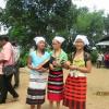
People: Himars, Zeme Nagas, Kukis, Biates, Karbis, Vaipheis, Hrangkhawls, Jaintias
Festivals: Bishu, Bishu Jidap, Surem Baino Bishu, Habgseu Manaoba Bishu, Hangso Manaubani Bagauthai
Last Updated : Thursday Jun 14 , 2012


