Area: 7,195 square kilometers
Density of population: 285 people per square kilometer
Literacy Rate: 74.61 % - Male: 82.59 %, Female: 66.21 %
Male Female Ratio: 1000:941
Boundaries of Dhule District
North: Madhya Pradesh
North West: Nandurbar District, Maharashtra
South: Nashik District, Maharashtra
East: Jalgaon District, Maharashtra
West: Gujarat
Dhule District Average Rainfall: 592 mm
Dhule District Maximum Temperature in Summer: 45 deg C
Dhule District Minimum Temperature in Winter: 6 deg C
DHULE DISTRICT MAP
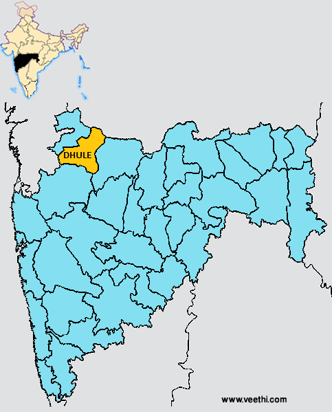
Major Rivers: Amaravati, Jamkhedi, Burai, Panzara, Tapi, Aner
Sub Divisions: Dhule, Shirpur
Taluks: Dhule, Sakri, Shirpur, Shindkhede
Assembly Constituencies: Dhule City, Dhule Rural, Sakri, Shirpur, Sindkheda
Dhule District Nearby Attractions
1. Ahilyapur
2. Amali
3. Balsane
4. Bhamer
5. Bodgaon
6. Chikse
7. Indave
8. Laling
9. Methi
10. Mudavad
11. Nagpur Kokale
12. Nizampur
13. Patan
14. Pimpalner
15. Shirud
16. Songir
17. Thalner
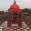
18. Sri Samartha Vagdevta Mandir
Dhule District Facts: NH 6, NH 3 and NH 211 pass through this district. So it is a popular stop for truckers.
Major Agricultural Products: Groundnut, cotton, jowar, chillies, sugarcane
What is Dhule District Famous For: Pure milk, educational institutions
Famous People From Dhule District: Ram V Sutar, Laxmanshashtri Balaji Joshi
Last Updated : Friday Jun 15 , 2012


