Date of formation: Gondia District was carved out of Bhandara District in 1999.
Area: 5234 square kilometers
Density of population: 253 people per square kilometer
Literacy Rate: 85.41 % - Male: 93.54 %, Female: 77.30 %
Male Female Ratio: 1000:996
Boundaries of Gondia District
North: Balaghat District, Madhya Pradesh
South: Chandrapur District, Maharashtra
East: Rajnandgaon District, Chhattisgarh
West: Bhandara District, Maharashtra
Gondia District Average Rainfall: 1197 mm
Gondia District Climate: Gondia District has hot summers and cold winters with an average humidity of 62 percent. South west monsoon winds bring rainfall from June to September.
GONDIA DISTRICT MAP

Major Rivers: Wainganga, Bagh, Chulbandh, Gadhavi, Bavanthadi
Sub Divisions: Gondia, Deori
Taluks: Gondia, Goregaon, Tirora, Arjuni Morgaon, Deori, Amgaon, Salekasa, Sadakarjuni
Assembly Constituencies: Gondiya, Amgaon, Arjuni Morgaon, Tirora
Dams: Itiadhoh, Sirpur, Pujaritola, Kalisara, Bodalkasa, Chorkhamara, Chulbandh, Managarh, Rengebar, Sangrampur, Umarzari, Katangi
Gondia District Nearby Attractions
1. Navegaon National Park
2. Nagzira Wild Life Sanctuary
3. Garmata Devi Temple at Salekasa
4. Conscious Temple at Gayatri Shaktipeeth
5. Ancient Shiva Temple at Nagra
6. Shri Saibaba Temple
7. Shri Chakradhara Swami Temple at Sukli
8. Mandodevi Temple
9. Mahadeo Hill
10. Shri Gurushing Sabha at Railtoli
Gondia District Facts: Gondia is called Rice City as there are more than 250 rice mills there. This is one of the 12 backward districts of Maharashtra that is receiving funds from the Backward Regions Grant Fund Program. NH 6 passes through this district.
Major Agricultural Products: Paddy, linseed, jawar, wheat, tur
What is Gondia District Famous For: Rice Mills
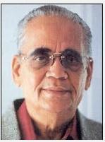
Famous People From Gondia District: Politician Khushal Bopche
Last Updated : Friday Jun 15 , 2012


